Posts about data
-
Download and Convert DEMs of Japan From the Japanese Geospatial Information Authority
The Geospatial Authority of Japan offers some of the best DEMs of Japan I’ve been able to find. (If you have tips for any others, please let me know!) That said, the website and download process is not as straightforward as what I’m used to from the USGS, and for people hoping to use the data in QGIS or other GIS programs, the data needs a significant amount of processing to get it into a format you can use. If you’re looking DEMs of Japan however, they seem to be the best game in town. Here’s how to get what you need.
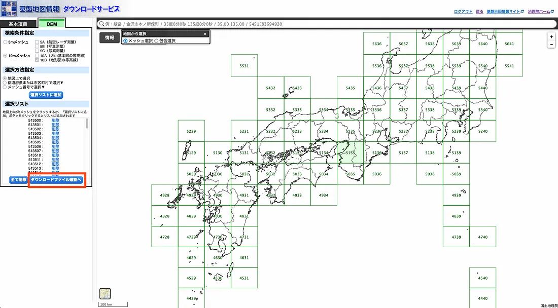
To download the DEMs you’ll need to go to the geospatial information authority’s website (https://fgd.gsi.go.jp/download/menu.php). You’ll need to create an account, and sign in. I created my account a while ago, and don’t remember the exact details, but Google Chrome will automatically translate the pages for you if you don’t read Japanese, so you should be able to get on well enough.
After you provide them with your personal information, they’ll send you an email with your username and password (in plain text, in the body of the email). After spending a couple minutes thinking about that, you can use those credentials to sign in.
Next, chose the resolution you’re after, and the area you’re interested in- in that order. Once you make a tile selection they won’t let you change resolutions.
Continue reading...