Map of Japan

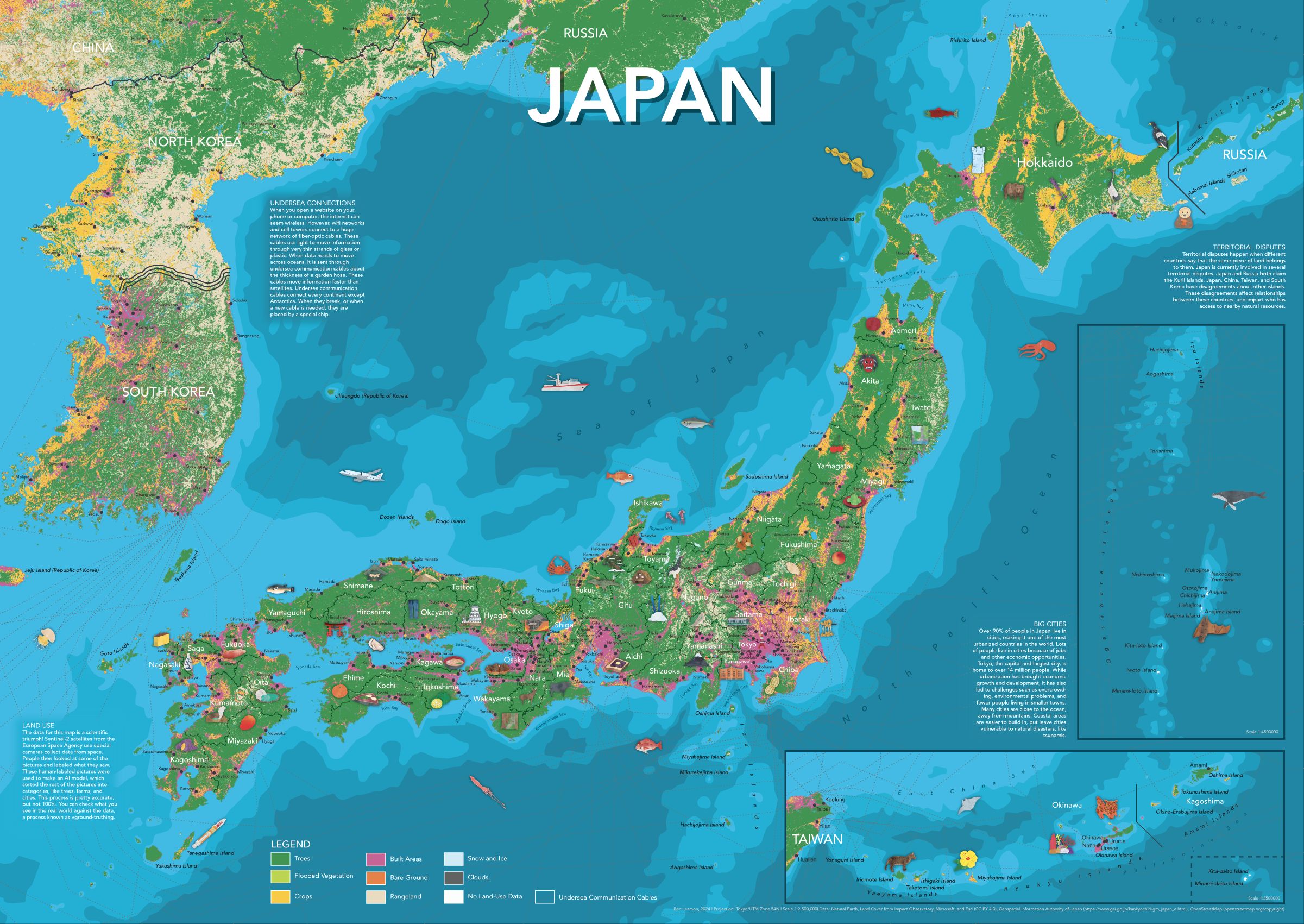
For the third (and possibly final) in my series of illustrated maps for kids, I made a map of Japan. As always, the map includes plenty of hand-drawn illustrations, prefectural and city labels, and info panels for more detail.

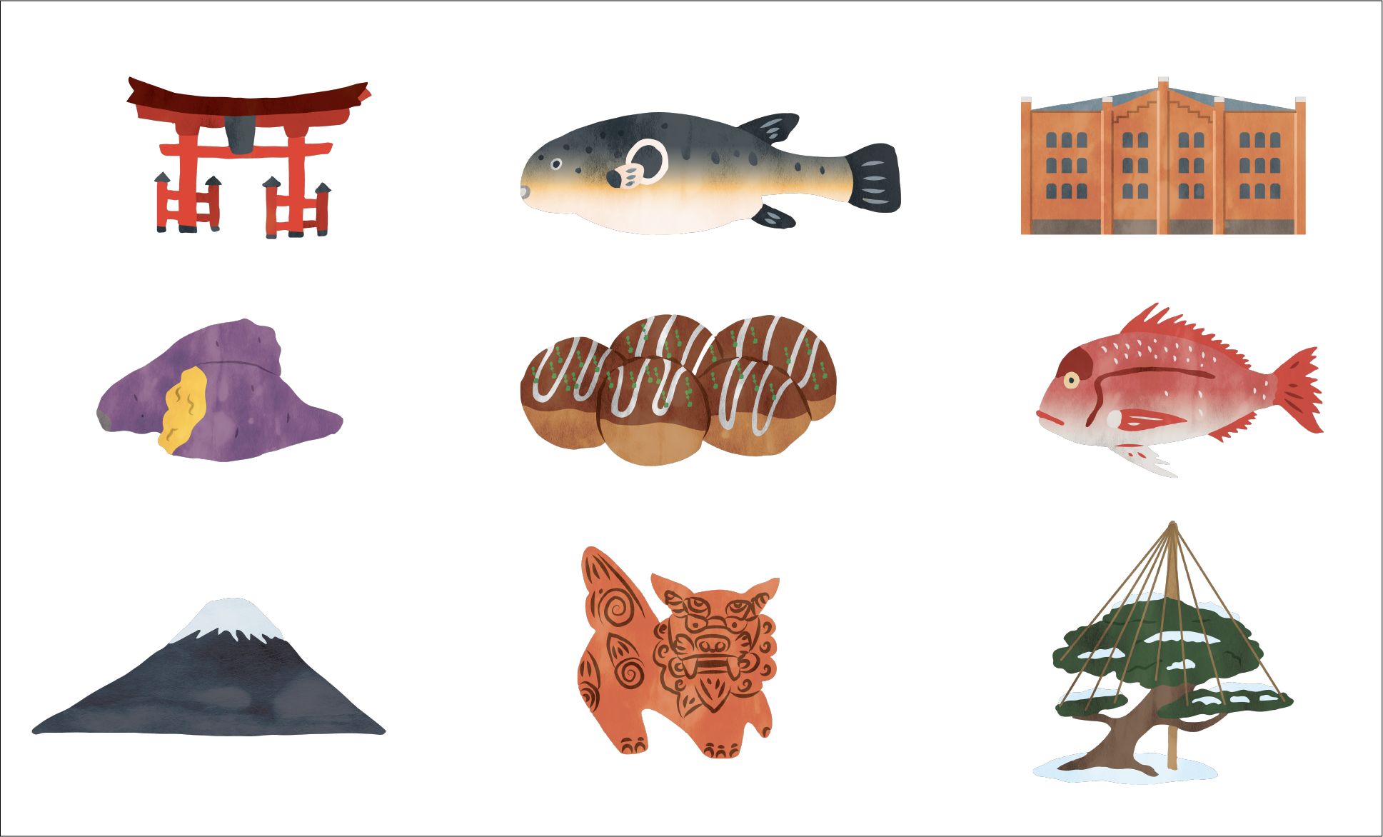
Some of the illustrations I made for the map.
If you're interested in getting a copy of the map, please email me and we'll figure something out. If you're interested in the map-making process, read on!
A New Basemap
Compared to my world map and my map of the United States, the biggest change is the basemap. Unlike the United States, and the planet, Japan pretty much consists of just a couple of climate zones, which would make things pretty boring to look at. Instead, I switched to land-use data which has lets you see Japan’s urban/non-urban divide, and is a decent proxy for which areas are too-mountainous to build.
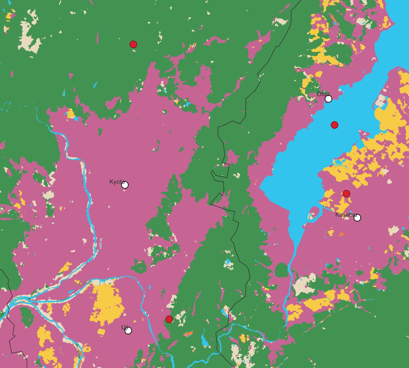
This, however, presented some interesting problems. Plenty of cities include lots of agricultural or otherwise non-urban area within their municipal boundaries. This meant that placing the label at the center of the city bounds led to the it appearing outside what people would usually think of as the city.
To fix this, I clipped the city bounds to the built area, and then placed the point and label at the center of that polygon. This required quite a bit of converting from polygon to raster data, and vice versa. Luckily, I was able to borrow a friend’s computer, which was much more powerful than my MacBook.

Here you can see that the red dots, placed at the center of the city boundaries, don't reflect the pink urban areas. Kyoto's dot is so far north! And Otsu's dot is in the middle of the lake! The updated white dots reflect center of the city's urban area.
Other Considerations
It felt important for me to include Korea, Russia, China, and Taiwan, highlighting the proximity of Japan's neighbors, and the connections between Japan and other countries. As with the US map, I also wanted to include undersea communications cables. I think it's good for people to be more aware of the physical infrastructure that undergirds the internet.
Finally, I had to make a decision on how to depict Japan's territorial disputes, of which there are many. In the end, I chose to depict things as they are on the ground. If, as a Japanese citizen, you need a passport to go there, I did not include it as part of Japan. It's obviously not my place to make a call on each individual claim, and since this is a map for kids, that felt like the most practical way to go. I also included an info panel on territorial disputes, so that readers can learn more about the issue and understand the decisions behind this map.
These maps are a lot of work, and I hope you enjoy them! If you have an idea of somewhere you'd like to see, please get in touch!