Posts about QGIS
-
QGIS2Blender - A Plugin for Preparing Terrain Data for Use in Blender
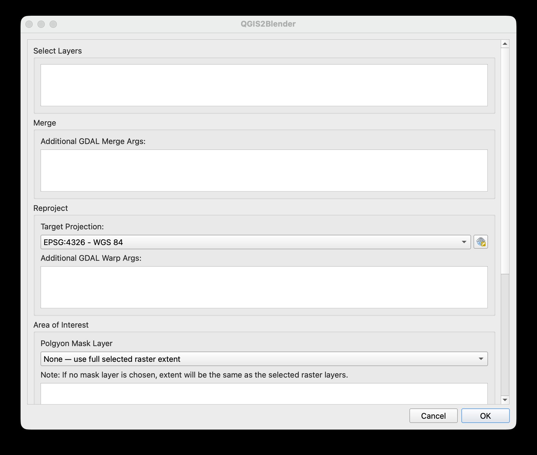
If you’ve ever tried bringing terrain data into Blender, you’ve likely found yourself repeating the same geoprocessing steps to prepare the data. DEMs often need to be merged, reprojected, clipped to an area of interest, rescaled, and finally exported as a 16-bit TIFF before Blender can use them as heightmaps.As an aside, if you’re wondering what Blender is, or why you might want to use it for geospatial data, I would highly recommend Daniel Huffman’s excellent series of tutorials. Shaded relief created in Blender has more realistic shadows, to my eye looks more beautiful, and just looks more 3D in general. It will make every hillshade you’ve created in QGIS feel like crumpled paper.
Alone, none of the steps required to prepare a DEM for use in Blender are particularly difficult but they quickly become tedious when repeated for every project. For Blender users who are new to GIS, the data preparation process can also be a barrier to entry.
QGIS2Blender is a plugin I made for QGIS, that brings this workflow together into a single tool, allowing you to quickly and easily create data that can be imported into Blender.
Continue reading... -
Map of Iceland
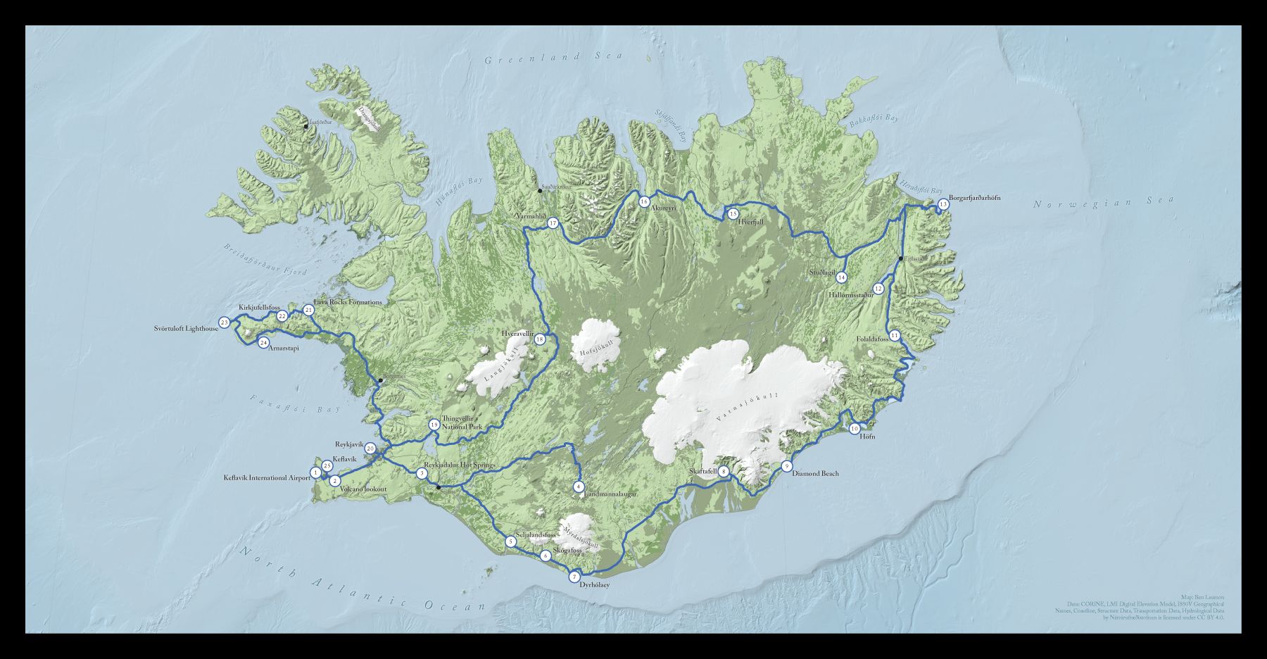
This is a map of Iceland I made for a friend. He wanted a map documenting a trip for his friend's wedding album. In this post I'll walk you through the creation process and explain some of the design decisions that went into the final map.The initial brief was to help make a map that was better than the default one generated by the publishing software he was using, which was ok, but I was pretty sure I could do better.
I downloaded almost all of the data for this map from the Náttúrufræðistofnun, or Natural Science Institute of Iceland. It was nice to have all the information I might need in once place, although English localization, especially in the metadata, was spotty. After some Google Translating and some internet research however, I was able to get the layers I wanted. (You should have a look at their map viewer if you have a moment. How cool is it that you can get seal habitats and the locations of Icelandic sagas all in one place?)
Continue reading...
-
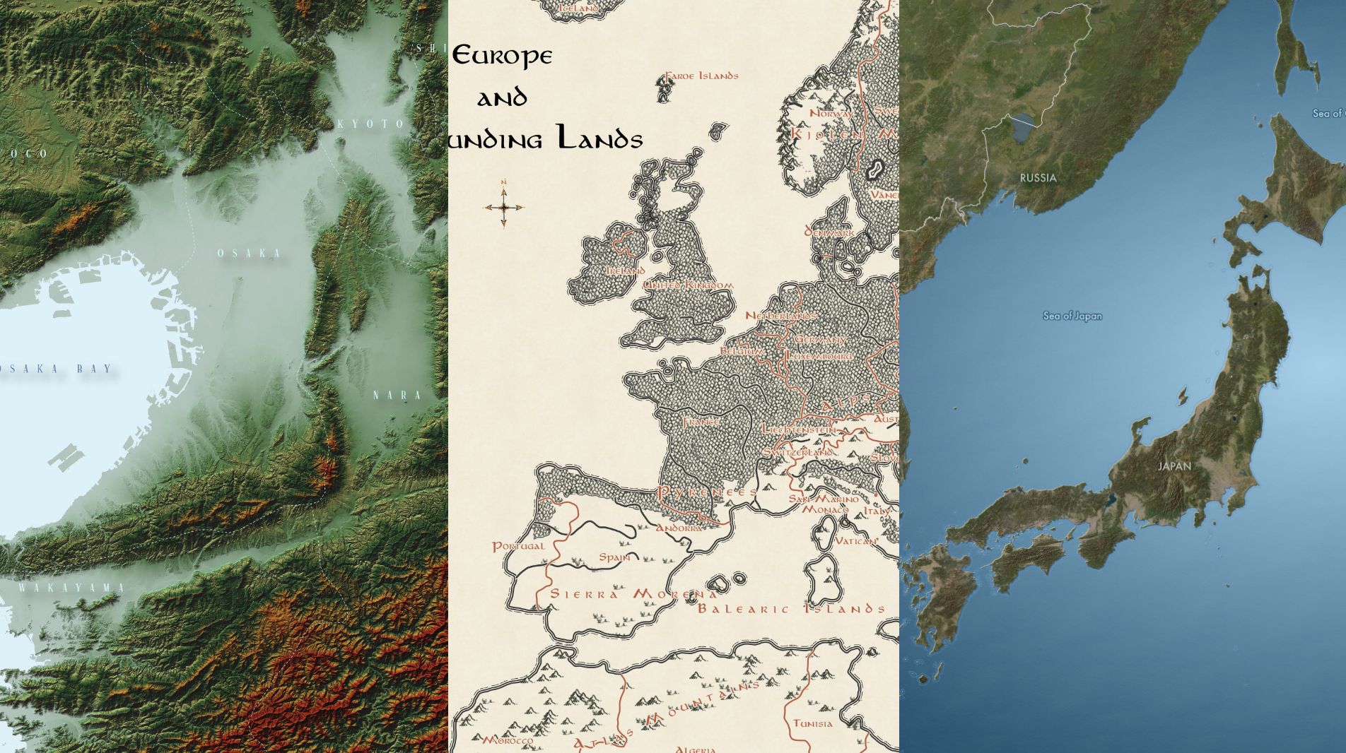
Map of Japan
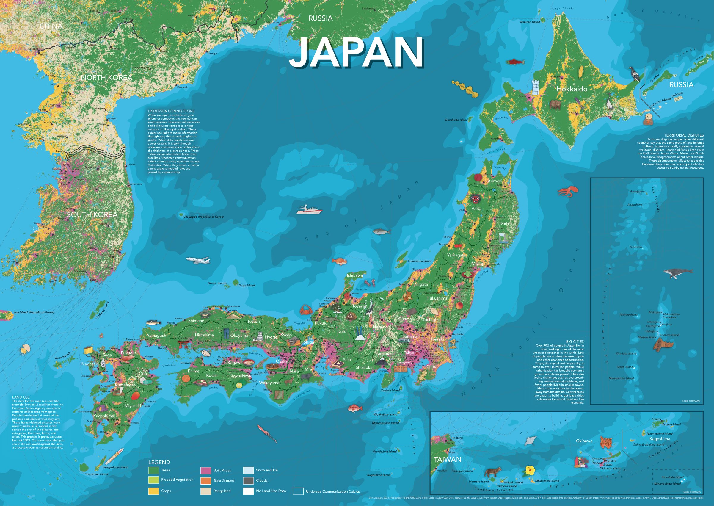
For the third (and possibly final) in my series of illustrated maps for kids, I made a map of Japan. As always, the map includes plenty of hand-drawn illustrations, prefectural and city labels, and info panels for more detail.
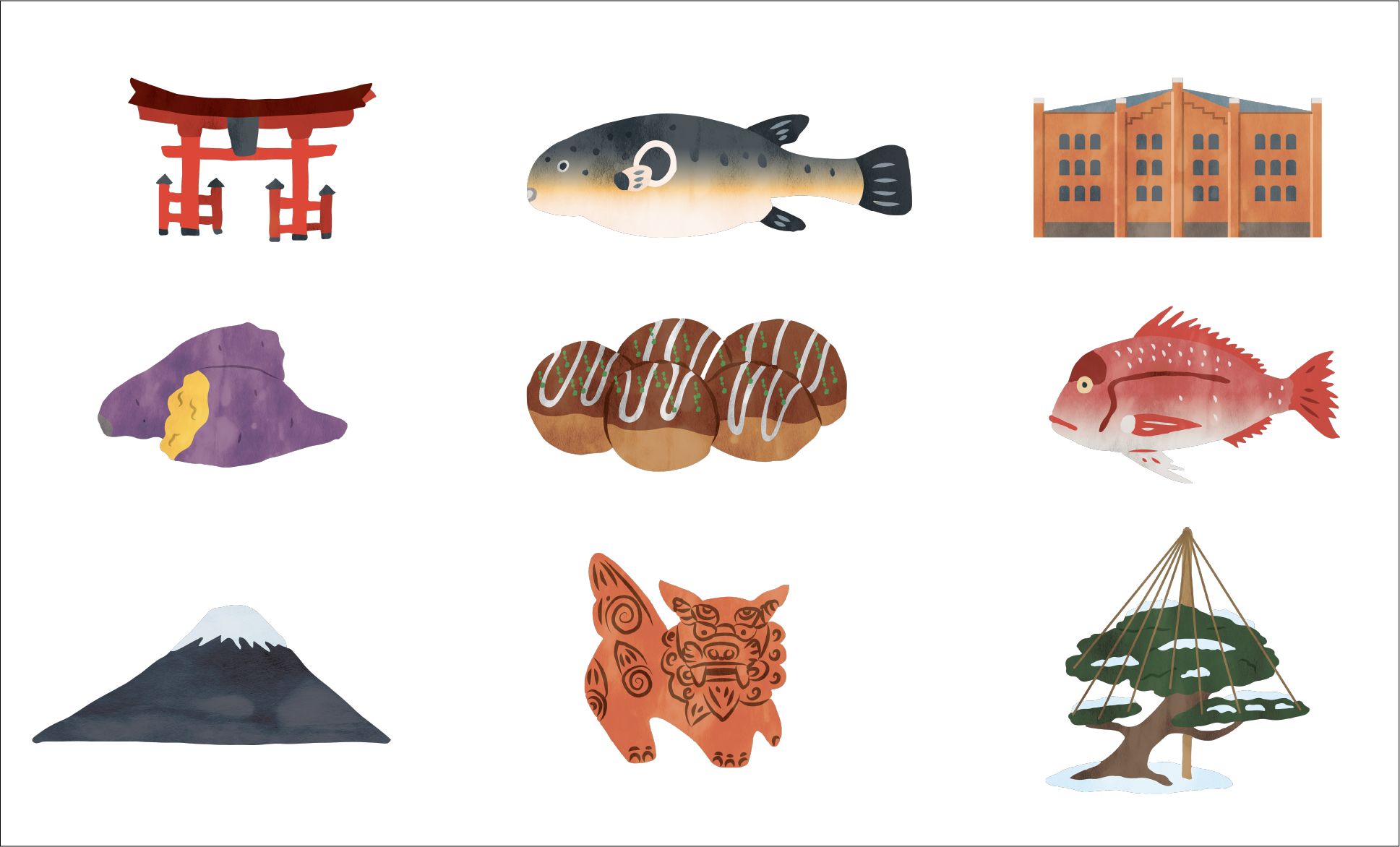
Some of the illustrations I made for the map.
If you're interested in getting a copy of the map, please email me and we'll figure something out. If you're interested in the map-making process, read on!
Continue reading... -
Map of the United States
A bit over a year after completing my world map, I’ve finished a map of the United States. In the same style as the world map, it features important cities, rivers, lakes, and ecoregions. Decorated with over 75 handmade illustrations depicting significant plants, animals, cultural and historical events, this map showcases some of what makes the US a unique and interesting place.
Continue reading... -
World Map
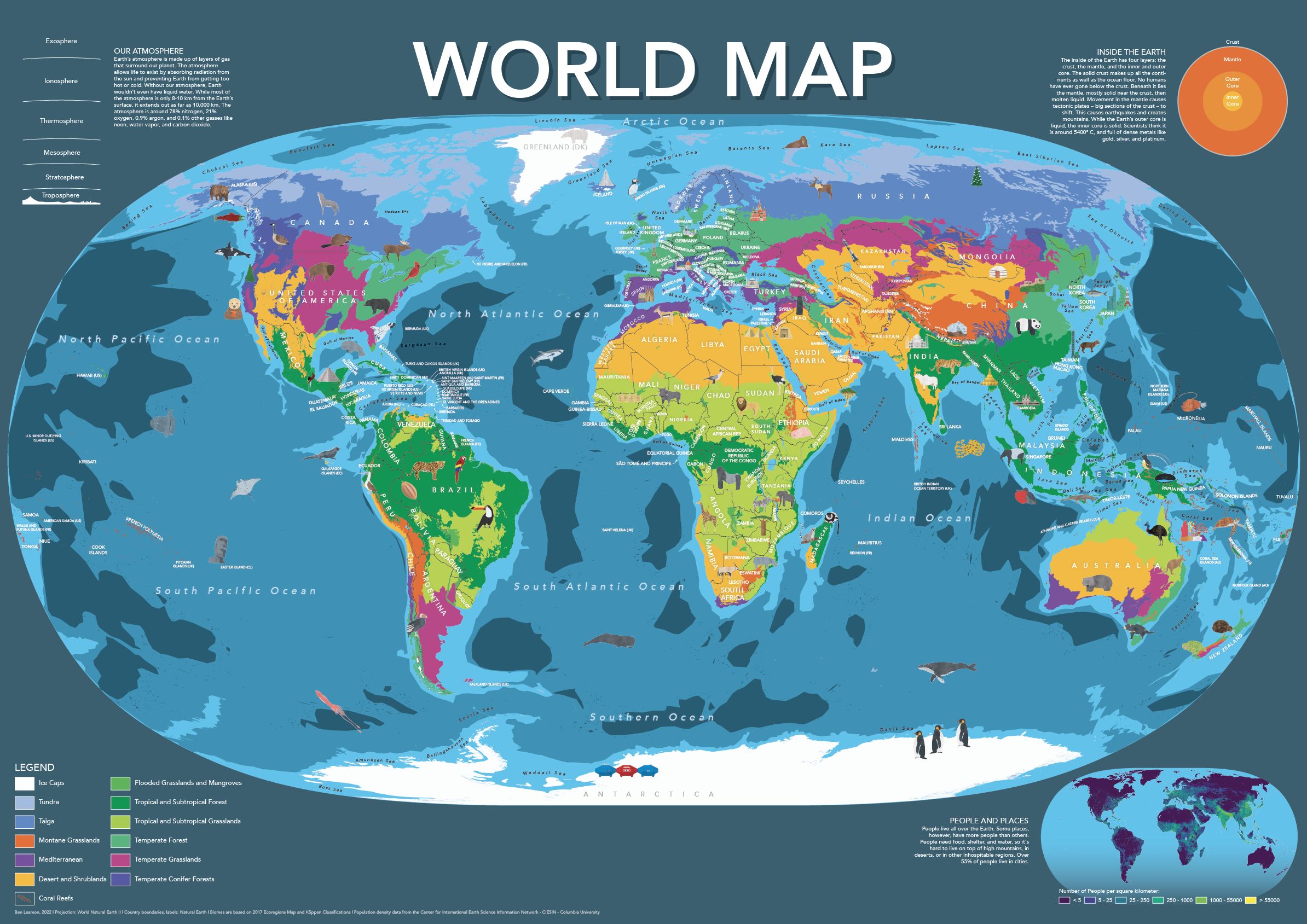
I made this world map for kids (or adults!) who want a playful, friendly, world map.
The map includes hand-placed labels for countries, overseas territories, as well as oceans and seas. Additionally, the map features nearly a hundred hand-drawn illustrations showcasing some of the most amazing plants, animals, and cultural accomplishments from around the world.
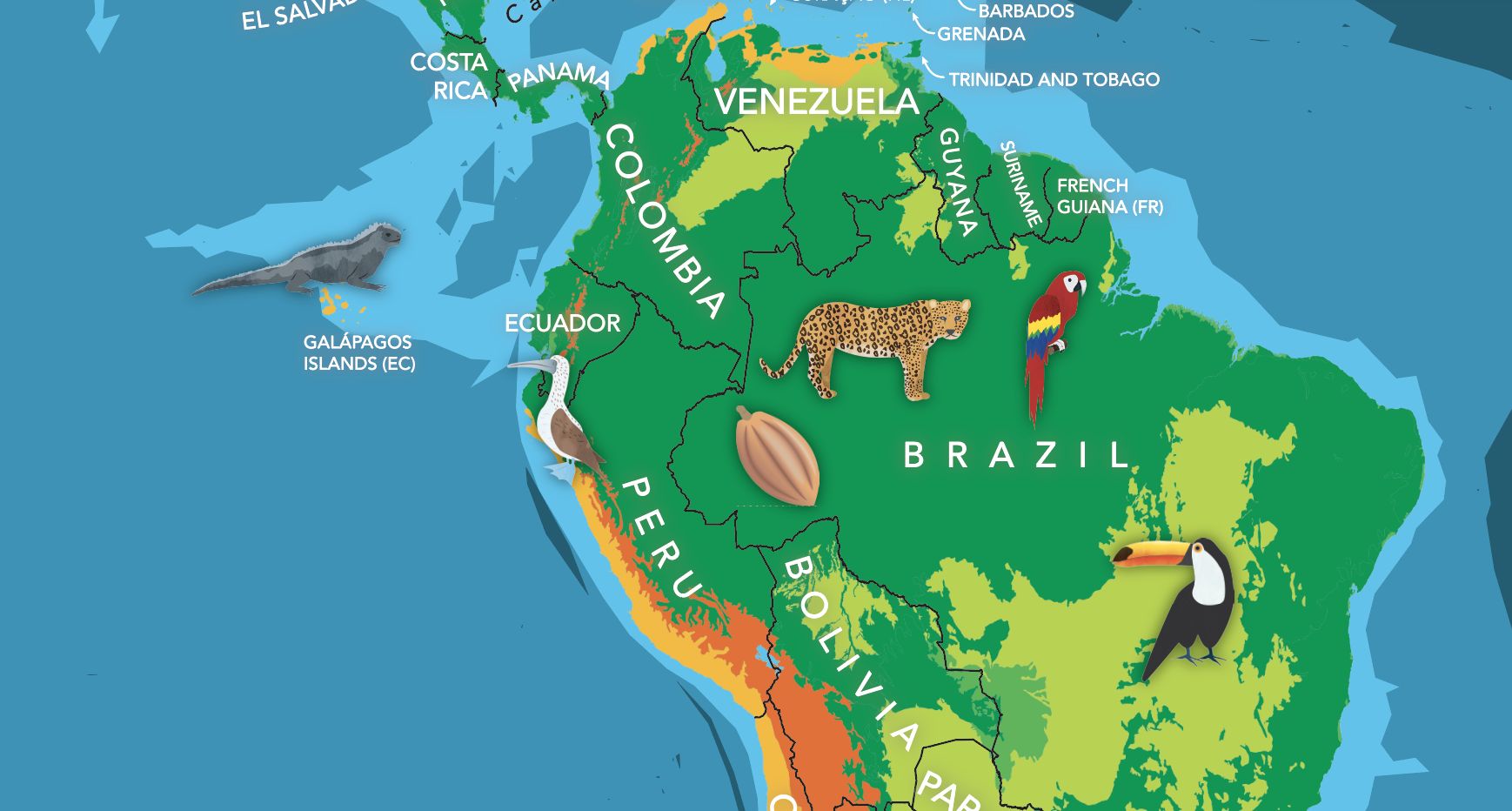
The base-map features climate zones, providing a clear and easy-to-understand visual representation of our planet’s diverse climates. Furthermore, the map includes informative panels on earth’s population, atmosphere, and core, making it a great educational tool as well.
Continue reading... -
Geologic Map of Japan in Blender
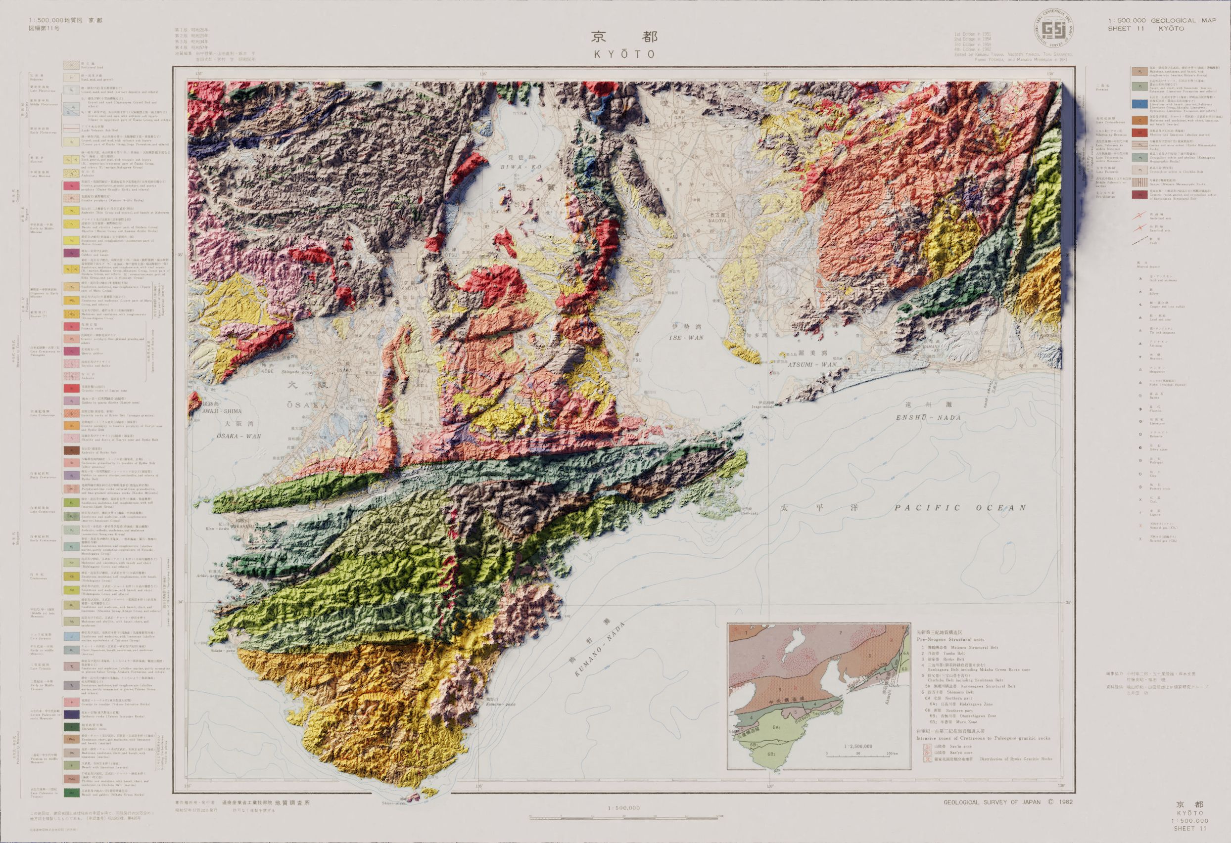
This is the first time I made in Blender using non-USGS data. The vintage map as well as the digital elevation model was readily available from the Geospatial Information Authority of Japan, but getting the data into a usable format was a bit of an adventure.
I haven’t done a full-size render of this one yet, so it might be a tiny bit fuzzy, but the key elements are all there!
Continue reading... -
Eckert V Trading Card
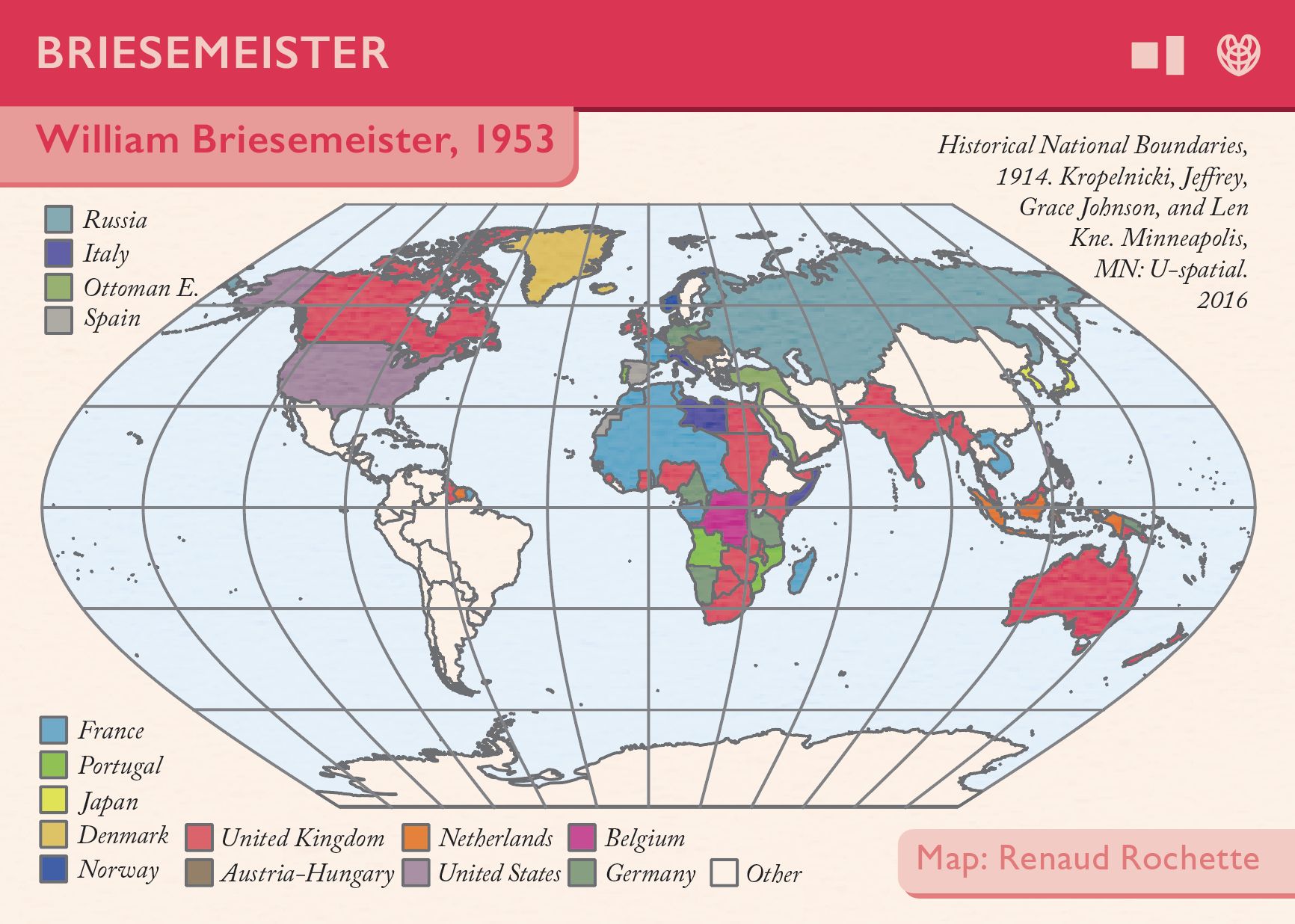
This is my contribution to Daniel Huffman’s projection cards project. My projection, Eckert V, isn’t recommended for use anymore, and was introduced in 1906. I thought it would be interesting to try and portray the world as it was when Eckert V was first released, with much of the world divided up between global empires. That data came from the University of Minnesota’s Historical National Boundaries dataset, which the authors very kindly granted me permission to use.
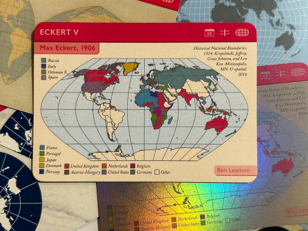
It was so much fun being part of a larger project, and thrilling to get a copy of my final card in the mail!
Continue reading... -
3D USGS Topo-Map in QGIS
While I would deeply, deeply love to report otherwise, a 2011 Macbook air is not the computer to use if you want to layer modern hillshades with vintage maps in Blender. After many fruitless hours trying, this is my best shot using QGIS alone.
I’m not entirely satisfied with the results. They’re a far cry from the soft light and gentle shadows I had been hoping for. Still, I think the results are decent given that everything was done in QGIS. You can read the full write-up for this project here.
Continue reading... -
Remaking John Nelson ArcGIS Tutorials in QGIS
John Nelson makes some amazing tutorials and how-to videos for ArcGIS. While I love ArcGIS, I wanted to see how close I could get using the free and open-source QGIS. For anyone looking to learn more about QGIS, I’d highly recommend this approach. The steps are sometimes fairly different, so it’s a great way to get to know the software.
I see this process as honing my aesthetic sense for what works on the page, as well as expanding my technical knowledge. It’s also good in that it gives you a project, and a rough set of ideas for how to proceed, but you can’t fall back on following a written list of instructions. You really have to do some research and figure out how to get QGIS to do what you want.
Occasionally I’ve had to start in QGIS before moving to Illustrator, and some of the tutorials have been flat out impossible given the differences in the programs, but it’s a great way to practice making visually-appealing maps, learn more about cartography, and push the limits of what QGIS can do.
I haven’t made step-by-step instructions for these maps the way John Nelson has, but if you have any questions, feel free to reach out and I’ll see what I can do to help.
Continue reading... -
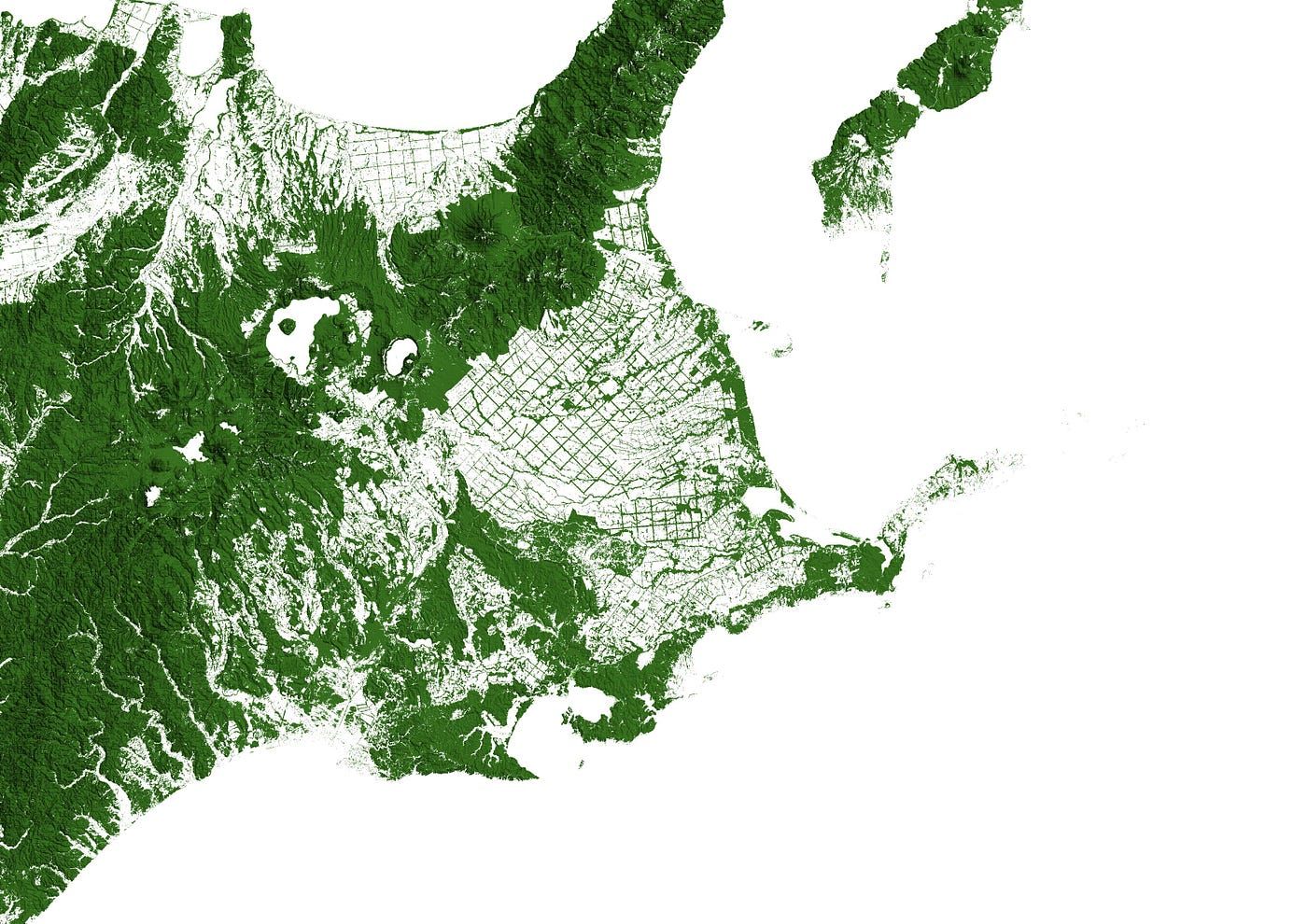
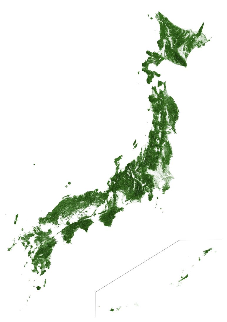
Forested Areas in Japan
While working on a different project, I came across these maps of forested land in the US, Australia, and Europe, from Earth Art Australia. I was at a bit of a roadblock in my other project, and making a map of forested land in Japan seemed like an interesting — and most importantly easy— diversion. The project, however, quickly spiraled into interminable raster-processing on my aging macbook air.
Highlights:
Compared to the maps of The US and Australia, the forests mapped closely to hills and mountains. North-Eastern Hokkaido, around Nakashibetsu, was interesting. Grids of agricultural fields are bordered by stands of trees.
Continue reading...