Posts about Illustrator
-
Map of Iceland
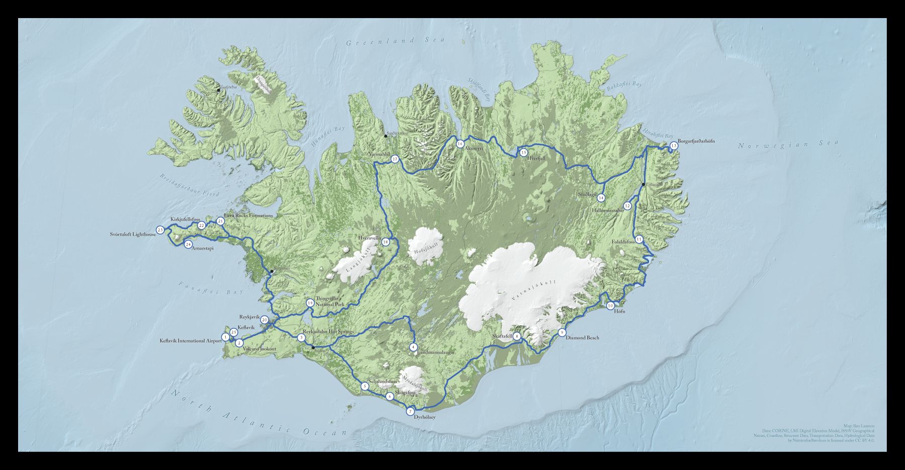
This is a map of Iceland I made for a friend. He wanted a map documenting a trip for his friend's wedding album. In this post I'll walk you through the creation process and explain some of the design decisions that went into the final map.The initial brief was to help make a map that was better than the default one generated by the publishing software he was using, which was ok, but I was pretty sure I could do better.
I downloaded almost all of the data for this map from the Náttúrufræðistofnun, or Natural Science Institute of Iceland. It was nice to have all the information I might need in once place, although English localization, especially in the metadata, was spotty. After some Google Translating and some internet research however, I was able to get the layers I wanted. (You should have a look at their map viewer if you have a moment. How cool is it that you can get seal habitats and the locations of Icelandic sagas all in one place?)
Continue reading...
-
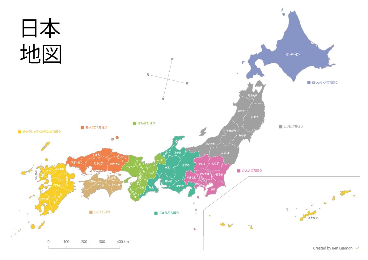
Map of Japan
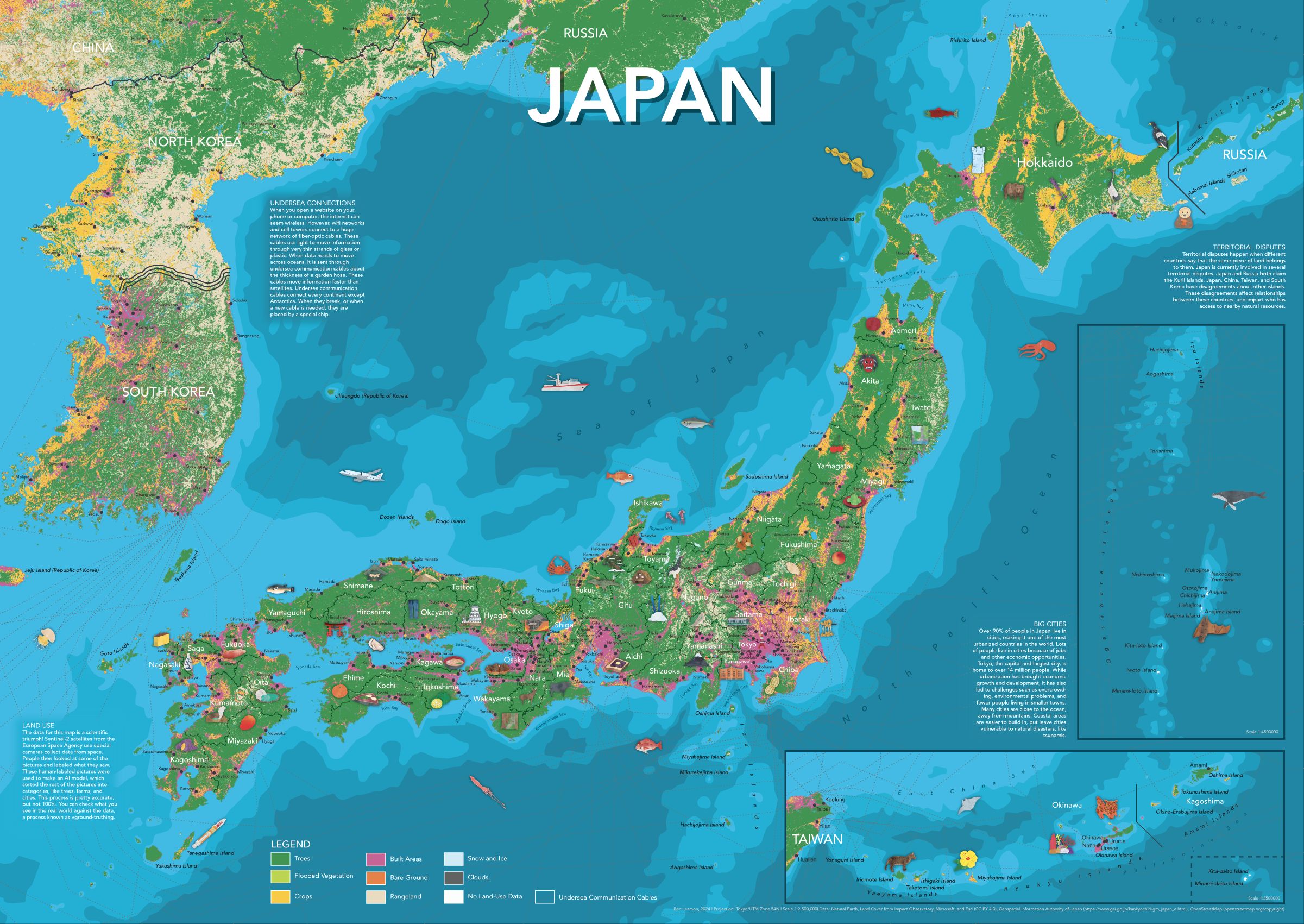
For the third (and possibly final) in my series of illustrated maps for kids, I made a map of Japan. As always, the map includes plenty of hand-drawn illustrations, prefectural and city labels, and info panels for more detail.
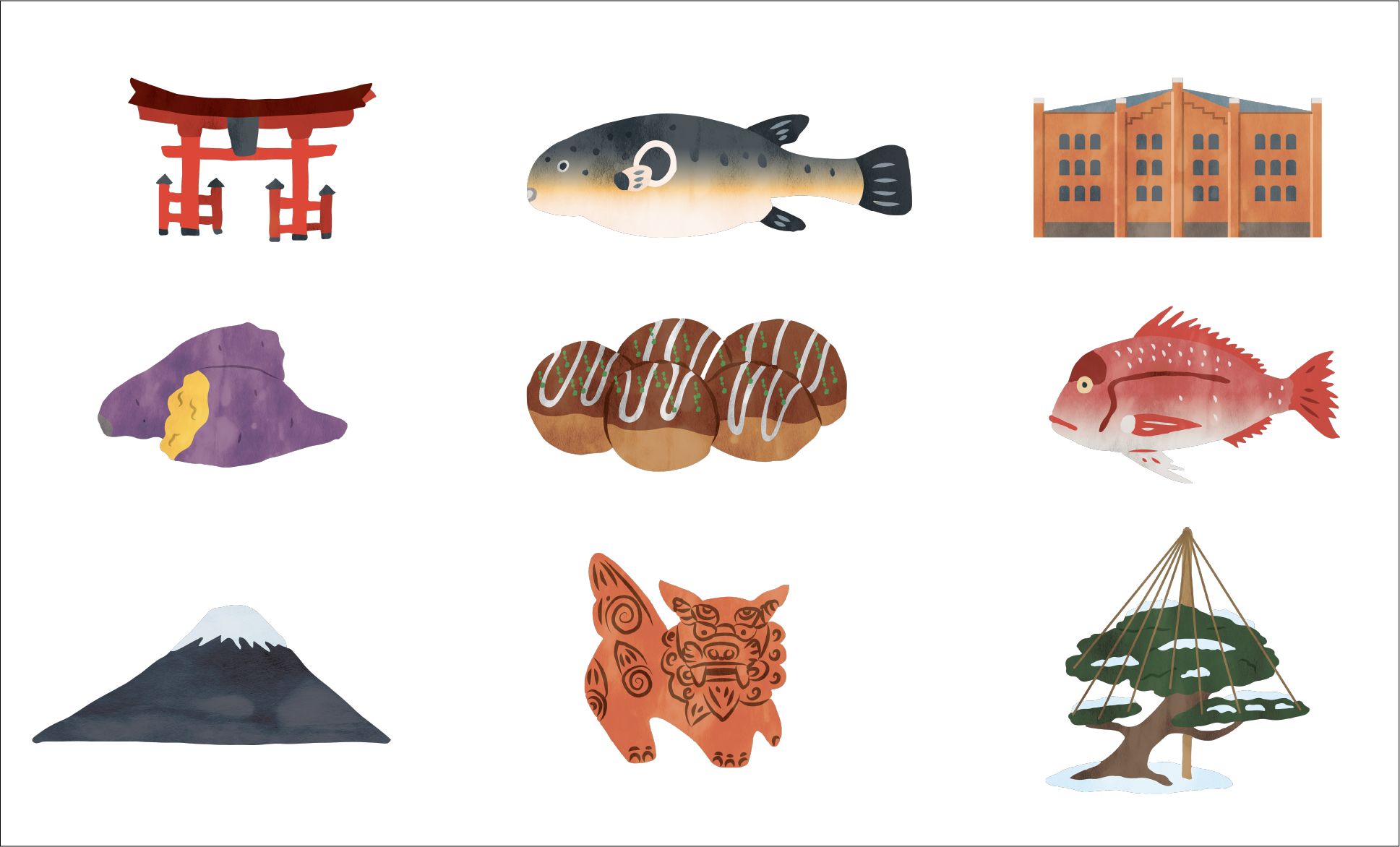
Some of the illustrations I made for the map.
If you're interested in getting a copy of the map, please email me and we'll figure something out. If you're interested in the map-making process, read on!
Continue reading... -
Map of the United States
A bit over a year after completing my world map, I’ve finished a map of the United States. In the same style as the world map, it features important cities, rivers, lakes, and ecoregions. Decorated with over 75 handmade illustrations depicting significant plants, animals, cultural and historical events, this map showcases some of what makes the US a unique and interesting place.
Continue reading... -
World Map
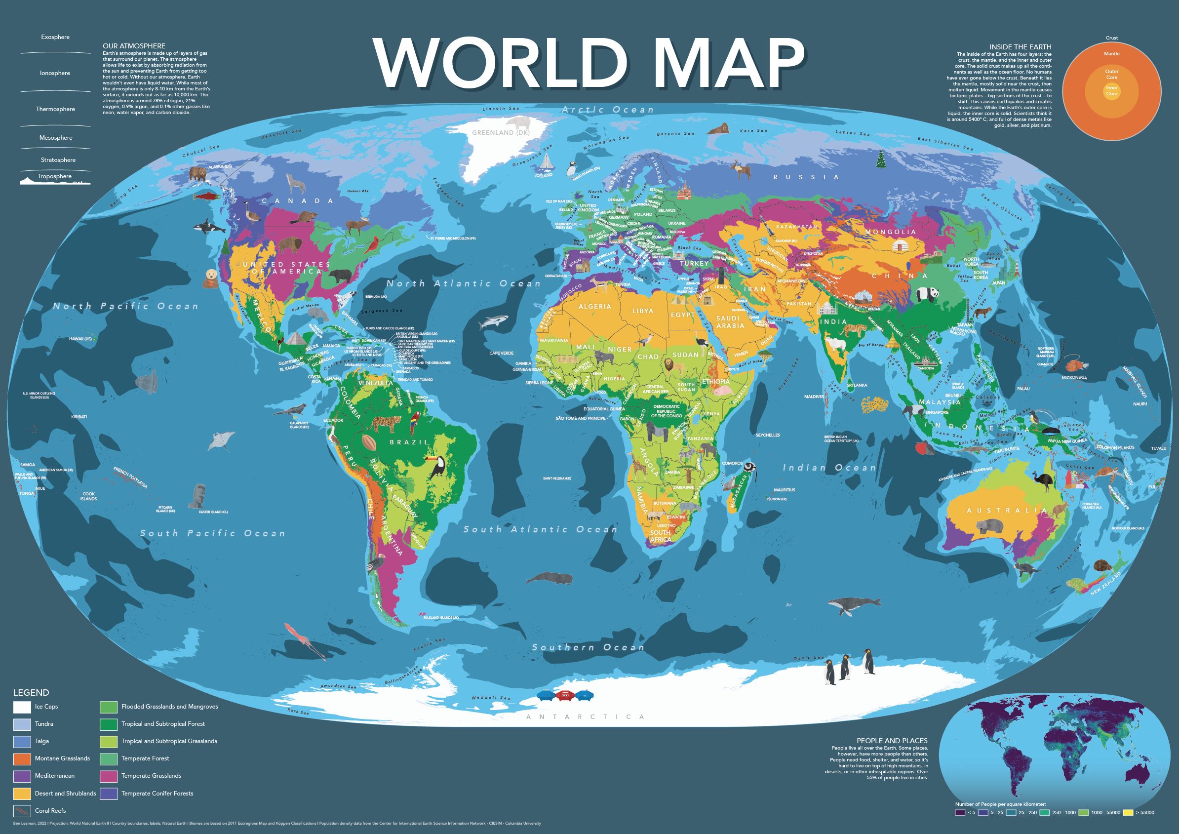
I made this world map for kids (or adults!) who want a playful, friendly, world map.
The map includes hand-placed labels for countries, overseas territories, as well as oceans and seas. Additionally, the map features nearly a hundred hand-drawn illustrations showcasing some of the most amazing plants, animals, and cultural accomplishments from around the world.
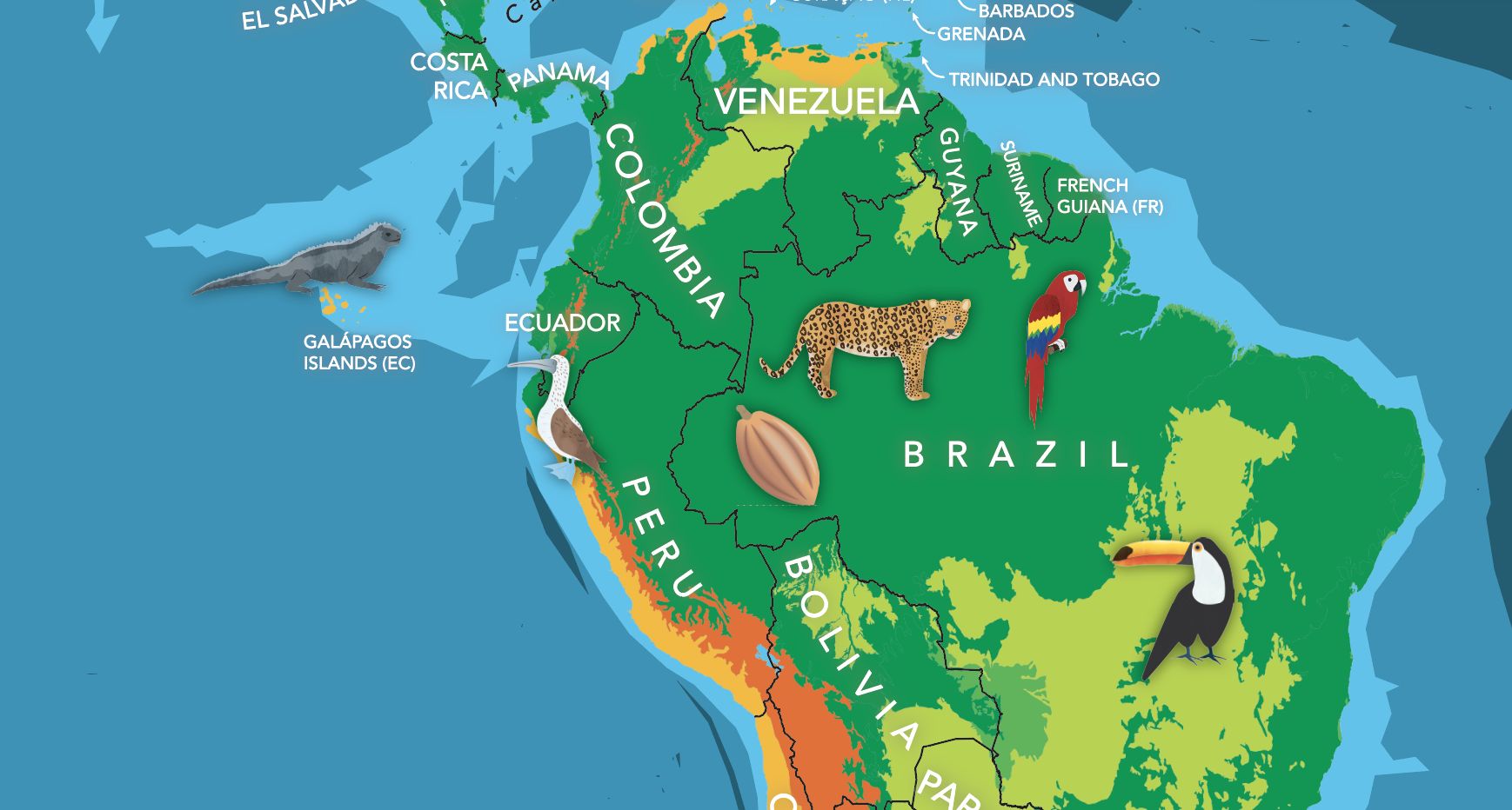
The base-map features climate zones, providing a clear and easy-to-understand visual representation of our planet’s diverse climates. Furthermore, the map includes informative panels on earth’s population, atmosphere, and core, making it a great educational tool as well.
Continue reading... -
Eckert V Trading Card
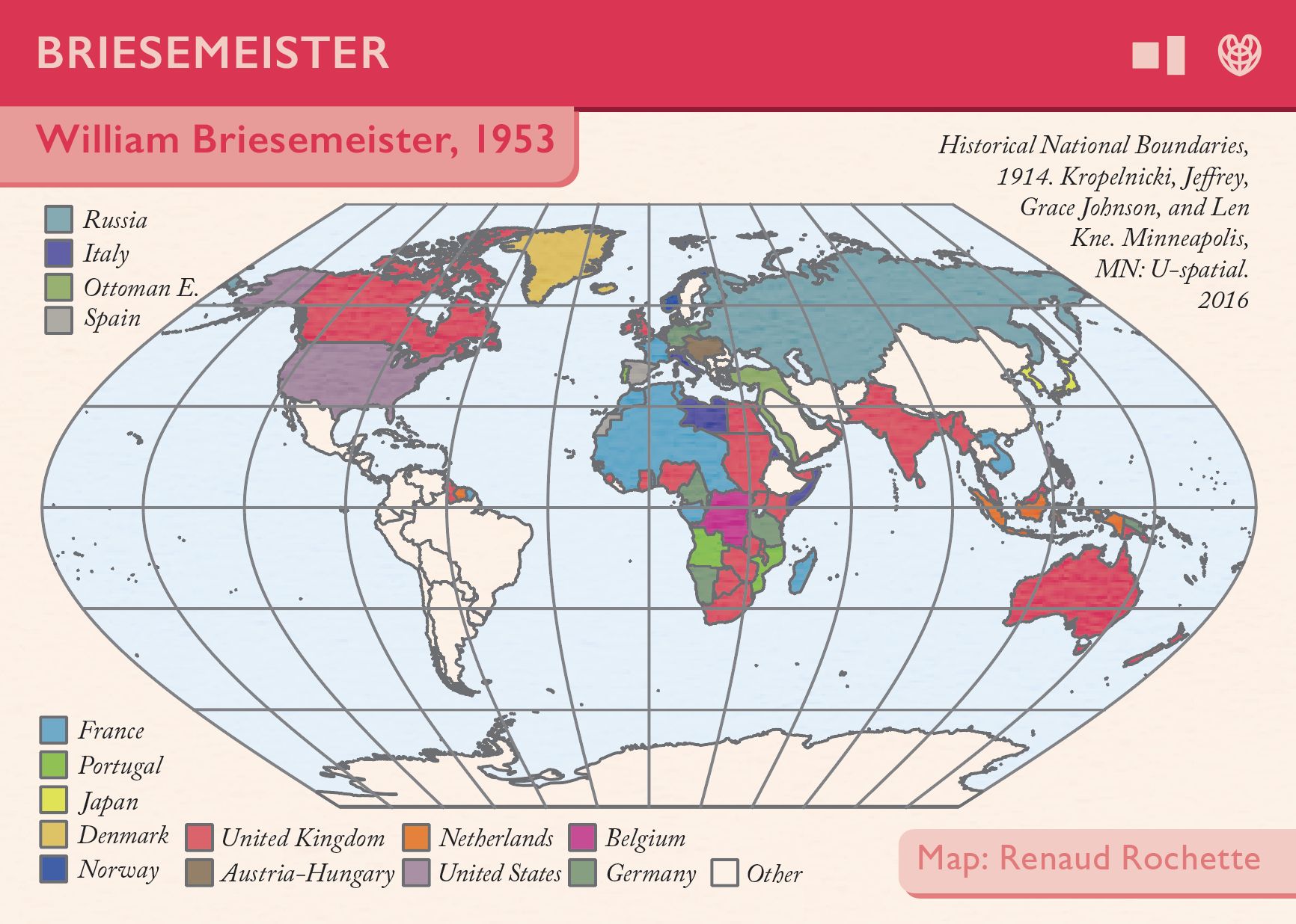
This is my contribution to Daniel Huffman’s projection cards project. My projection, Eckert V, isn’t recommended for use anymore, and was introduced in 1906. I thought it would be interesting to try and portray the world as it was when Eckert V was first released, with much of the world divided up between global empires. That data came from the University of Minnesota’s Historical National Boundaries dataset, which the authors very kindly granted me permission to use.
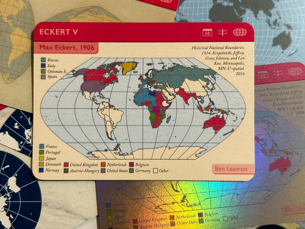
It was so much fun being part of a larger project, and thrilling to get a copy of my final card in the mail!
Continue reading... -
Simple Map of Japan
This is a simple map of Japan that I made in 2017 to get into the swing of things with QGIS and practice styling a simple QGIS map in Illustrator. If you’d like a copy, feel free to download and print it!
Continue reading... -
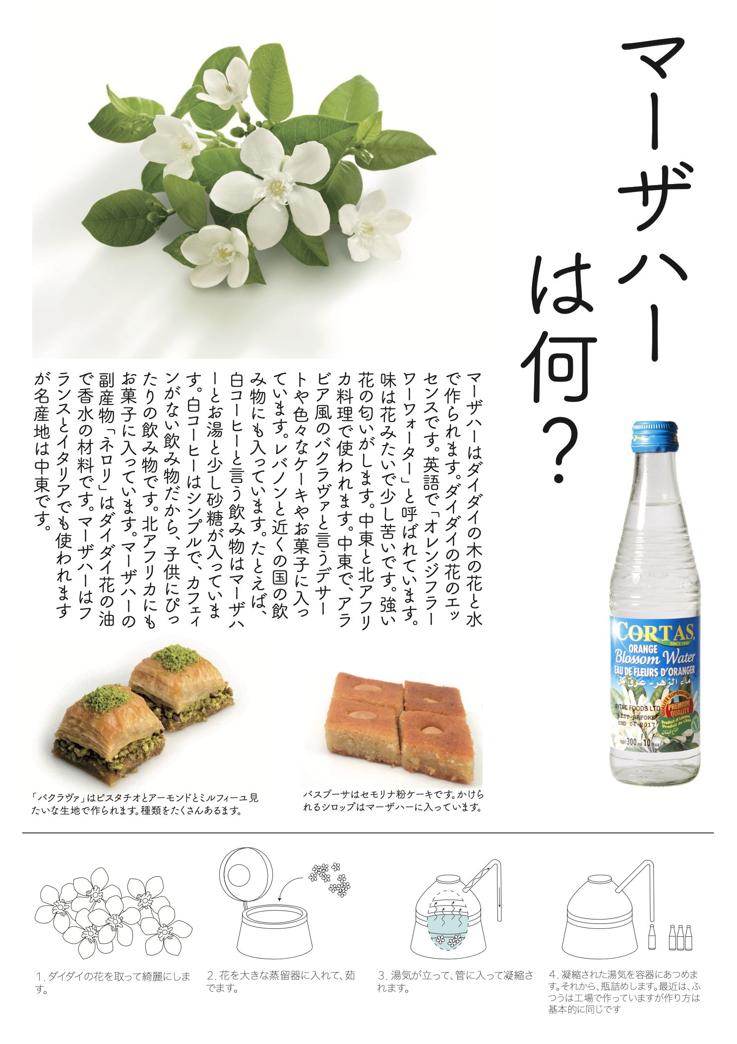
Orange Blossom Water Infographic
Orange blossom water is a versatile ingredient used in Middle Eastern cuisine. It has a unique, fragrant flavor which is truly delightful. I made this infographic to practice using Illustrator and as a project for a Japanese class I was taking. As a brief caveat, my 2016 Japanese was not what it is today, and that lack of experience probably shows.
Continue reading...